Page content - Navigation bar - Next
page - Previous page - Index ABC (EN)
- Intro-EN
- NL ![]()
Intro-EN

East-part (Nord-Pas de-Calais)
On this page:
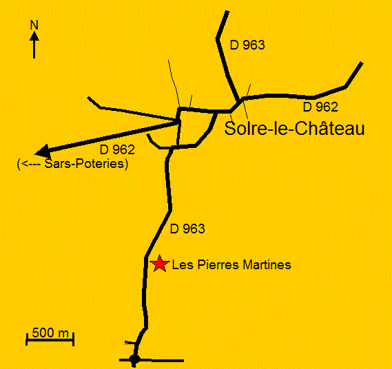
Solre-le-Château:
"Les Pierres Martine", Sars Poteries:
"Pierre de Dessus-Bise", Vendegies-sur-Ecaillon:
"Le Gros Caillou"
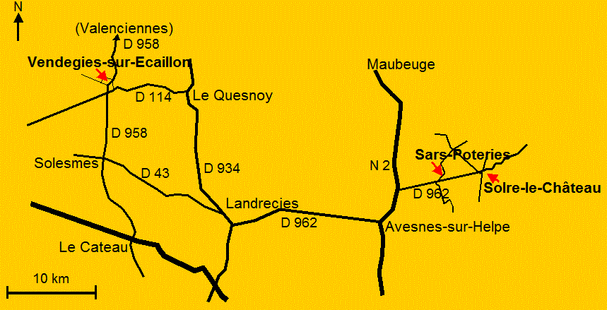
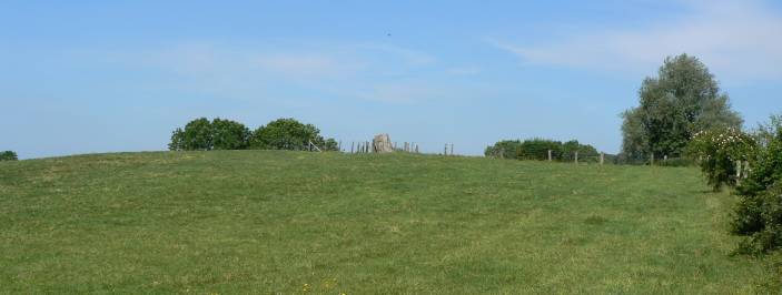
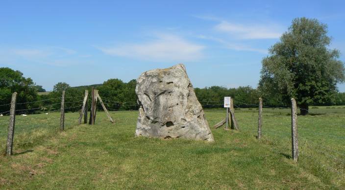
Solre-le-Château
"Les Pierres Martines": Sometimes megaliths know how to hide...
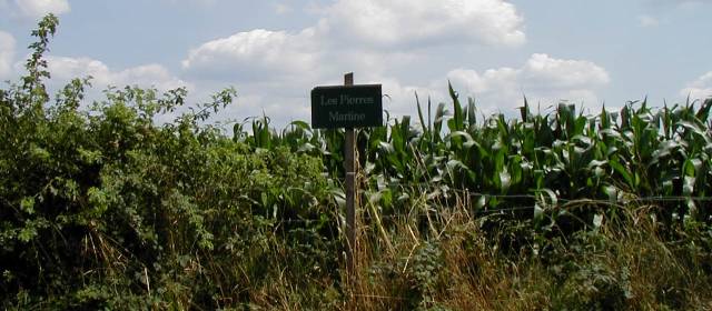
"Les Pierres Martines" - Name sign
Originally over here where
three stones*, two remain.
The third stone was demolished in the 19th century, and used as road pavement.
The megaliths where shaped in a local sandstone (Sandstone from Landen).
* = According to Brou there where once five
stones, a big one and four smaller ones.
(Les mégalithes de Gaule Belgique - Willy & Marcel Brou, 1988, p.269)
A legend tells Saint Martin, as soldier in Constantine's
Roman Legion,
rested leaning on one of the stones. The stone kept an impression of his back.
Probably this refers to the stones Christianisation by Saint Martin,
who was a destructor of pagan temples.
Info source: Brochure Tourist Information Solre-le-Château
Sars Poteries
"La Pierre-sous-Bise", also called "Pierre Dessus-Bise"
and "Pierre Sybise".
This nice stone gives creates a typical atmosphere on the marked place "Place du Vieux-Marché".
Megalith created in sandstone (Landen), 1,5 meter high, conic form,
diameter on base 2m80, on de top only 70 cm.
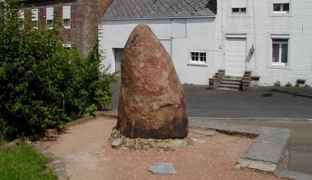
"La Pierre de Dessus-Bise" - Sars Poteries
In the top once a square hole was made to hold a flagpole.
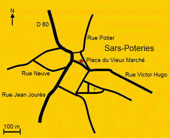
About 10 kilometres earthwards Solre-le-Château, near Sautin in
Belgium, the stones called "La Pierre-qui-Tourne".
(--> Sautin -
Belgium:
Pierre-qui-Tourne)
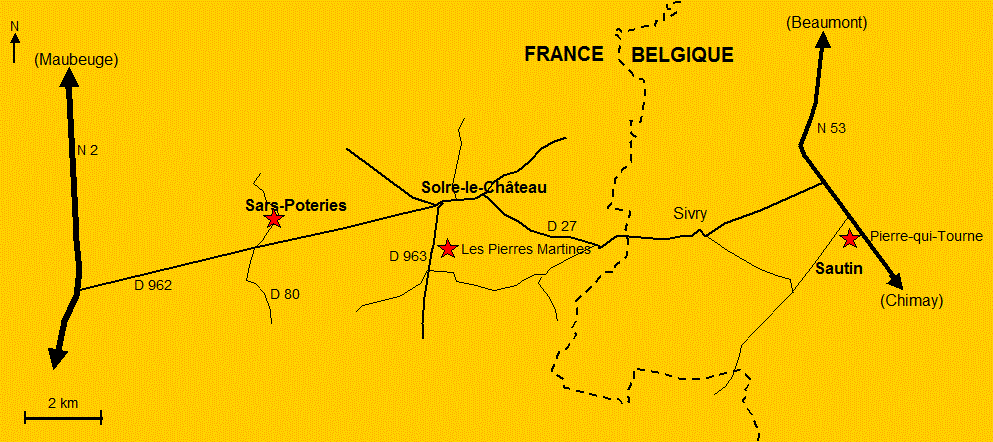
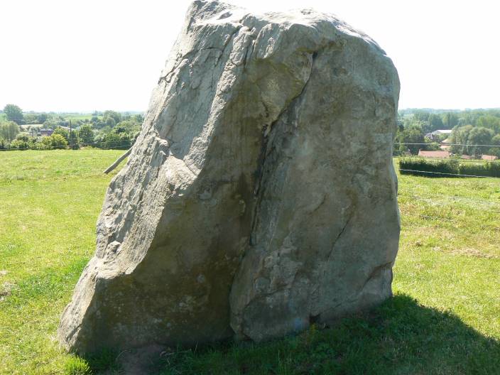
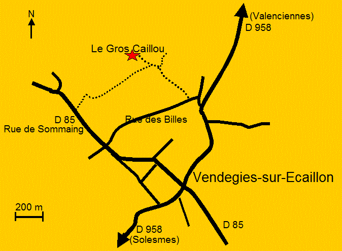
Vendegies-sur-Ecaillon
Laying on a little hill "Le Gros Caillou"
(The Fat Stone) is dominating the Ecaillon valley.
The stone is also called "Grès Montfort", referring to nearby hamlet.
Le Gros Caillou" - Vendegies-sur-Ecaillon
The width of this trapezoidal sandstone is around 2m50 width
at base, on top around 1m40.
Thickness approximately 1 meter, height near 2 meter.
"Le Gros Caillou" - Vendegies-sur-Ecaillon
"Le Gros Caillou" - Vendegies-sur-Ecaillon
Since centuries children are told mothers find their newborn baby's under the stone....
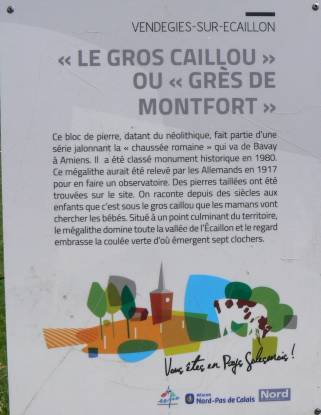
Info panel
The information panel describes the fallen stone was set-up
again by German soldiers in World War I,
to serve as on observation post above the valley.
An other source* disagrees on that story, saying all this was only German
'toughness'.
(* http://bruno-vendegies-genealogie.e-monsite.com/pages/vendegies/la-prehistoire-le-menhir.html)
Colourless maps for printing: Maps Nord (pdf)
Via road "D114", passing south of Vendegies we can go to Cambrai (+- 20 km)
'Back to top' - Cambrai (= Next page)